
From the Crown Down
Summary:
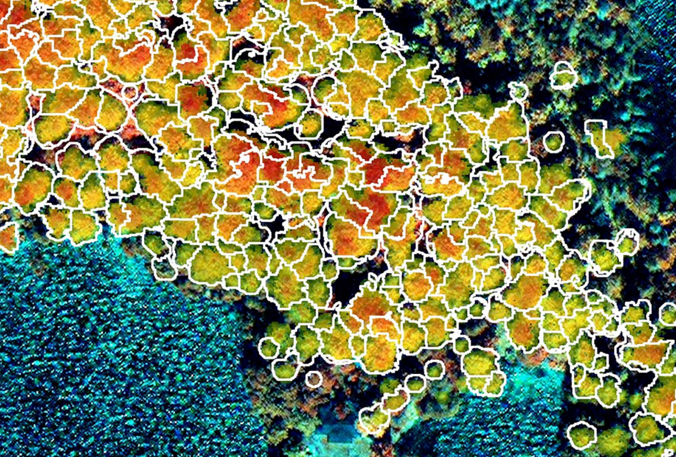
With nearly 50 percent of Quebec—76 million hectares (57 million acres)—covered in forest,
forest management in this Canadian province is serious business. A key supporter of this
business is the Centre D’enseignement et de Recherche en Foresterie de Sainte-Foy
(CERFO), which develops applied research tools for the industry. Recent research using
very high-resolution satellite imagery, lidar data, and object-based image analysis (OBIA)
software studied the ability to automatically identify individual Broadleaf and Conifer tree species
in dense, complex forests. The successful test may plant a new path for efficient, targeted
tree management.
Interesting related content:
- Project & Rule Set Examples: Tree Crown Delineation
- Webinar: Data Fusion Approaches to Tree Canopy Change Detection
- Webinar: Timber Cruising with eCognition
Was this article helpful?
0 comments
Your Answer
Articles in this section
- From the Crown Down
- Classifying the Caribbean's Coral
- Returning the Great to the Great Barrier Reef
- Harvesting A Major Vegetation Map
- Answering the Call for 3D City Models
- Just the Citrus Trees Please
- Bringing Relief to Refugees
- Roads Drive Better Understanding of Urban Growth
- Bucking Tradition
- Complex by Nature