
Vineyard Canopy Mapping
The UAV-based DSMs have recently been used in agricultural applications, for example to calculate tree/plant area, height, and crown size to assess biomass volume. eCognition offers a unique data fusion approach to use the full information potential of UAV-based elevation and image data.
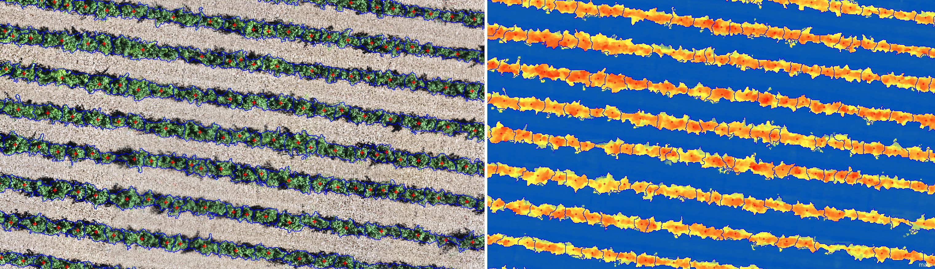
On a UAV-based dataset provided by University of Sassari - Dipartimento di Agraria, Christian Weise developed a rule set to extract the position, height, and crown volume of vine plants.
Important algorithms used in this project:
- pixel min/max filter (prototype)
- layer arithmetics
- automatic threshold
- watershed segmentation
- convert image objects to vector objects
Download 'Example Project - Vineyard Canopy Mapping'
Interesting related content:
- Project & Rule Set Examples: Layer Arithmetics
- Project & Rule Set Examples: Tree Crown Delineation
- eCognition Deconstructed video: Layer Arithmetics
- eCognition Deconstructed video: Automatic Threshold
- eCognition Deconstructed video: Watershed Segmentation
- eCognition Deconstructed video: Thematic Layer Operation Algorithms Create / Convert / Remove
Was this article helpful?
0 comments
Your Answer
Articles in this section
- 3D Powerline Vegetation Risk Analysis
- Python Hexagon Segmentation
- eCognition Oil Palm Application (1.3) Architect Solution
- Architect Solution - Power Line Risk Area Extraction
- Pixel-Based Object Resizing Surface Tension Artificial
- Pixel-Based Object Resizing Object Generalization Complex Landcover
- Building Generalization
- Customized Image Object Fusion
- Hexagon Segmentation
- Clearance Mapping around Powerlines